Precise measurements for your confident decisions.

We provide comprehensive geodetic services – from land surveying for residential houses to complex engineering structures. Rely on technology and expertise that speak a clear language.

I am interested
measure-logo-MINI.png, 70kB

Tradition built on precision.

In our geodetic office, we believe that every millimeter counts. We are a team of experts equipped with modern technical gear (Leica/Trimble brands), combining field experience with precise office processing.

Our goal is to simplify the construction process and the administration associated with the land registry for you.

Have questions?

Write to us. Planning a construction, buying land, or do you need a geometric plan? Fill out this short form and we will prepare a non-binding price offer tailored to your needs.

measure-mini-2.png, 17kB

Our Services

Engineering Surveying

Pre-project surveying:

Digital topographic and hypsometric data (site plans) essential for the designer's work.

Setting out of structures:

Precise transfer of the project to the land – from foundation strips to the placement of technological units.

Control measurements:

Monitoring the settlement of buildings and checking precision during the execution of construction works.

GNSS measurements:

Using state-of-the-art satellite systems for maximum speed and efficiency in the field.

Benefits

6 main advantages of our geodetic services

1. Millimeter precision without compromises

In geodesy, "approximately" does not exist. We use high-end robotic total stations and digital leveling instruments that eliminate human error. Your building will be placed exactly according to the project, preventing expensive corrections in later stages.

contact form

2. Legal protection and peaceful neighborly relations

Clearly defined boundaries are the foundation of good neighborly relations. Our surveying and boundary marking carry full legal weight for the Real Estate Cadastre. We protect you from unauthorized encroachments on your land and future legal disputes.

contact form

3. Acceleration of the approval process

We will prepare complete documentation for you – from the geometric plan to the address point survey. Our outputs meet all current legislative requirements, which significantly shortens processing time at authorities and speeds up obtaining a house number.

contact form

4. Cost savings on earthworks

Thanks to precise volume calculations and digital terrain models, you know exactly how much material needs to be excavated or brought in. Geodetic control during construction prevents waste of building materials and optimizes transport costs.

contact form

5. Modern technology and speed of delivery

We use drones and GNSS (GPS) technologies, allowing us to map even large areas in a fraction of the time compared to traditional methods. For you, this means shorter waiting periods and faster delivery of finished data in digital form (DWG, PDF).

contact form

6. Comprehensive consulting and support

We don't just hand over a piece of paper with numbers. We help you navigate the maze of cadastral laws, advise on property legal settlements, and explain the differences between various types of land parcels. We are your professional partner throughout the project.

contact form

Special Geodetic Works

We use modern technologies for fast and detailed data that you cannot obtain using traditional methods.

3D Laser Scanning:

We capture millions of points per second. Ideal for facades of historical buildings, complex steel structures, or interiors before renovation.

Aerial Photogrammetry (Drones):

Mapping of large areas, material stockpiles, or quarries. You get a detailed orthophotomap and a precise 3D terrain model.

Volume Calculations:

Accurate determination of excavation work volumes or stockpiles using a digital terrain model.

BIM Models:

Creation of Building Information Models based on point clouds, serving for modern building management and design.

Land and Ownership

This section is for landowners who need to resolve legal relations and entries in the cadastre.

  • Geometric plans: For splitting/merging parcels, surveying buildings under construction (for mortgages), or final building approval.
  • Boundary setting out: Precise determination of land corner points in the field so you know exactly where to build your fence.
  • Property legal settlement: Documentation for recording easements or settling ownership rights.

Preparation and Realization of Constructions

Services aimed at designers and builders, ensuring the structure stands exactly according to the approved project.

  • Pre-project surveying: Creation of digital topographic and hypsometric plans as a basis for the architect's work.
  • Construction stakeout: Transferring building axes and elevation levels from the drawing directly to the construction site.
  • Control measurements: Monitoring the verticality of structures, object settlement, and as-built surveys (e.g., for utility networks).

Modern part of geodesy processing data into digital models and information systems.

  • 3D Laser Scanning: Millimeter-precise surveying of facades, historical buildings, or complex industrial halls into point cloud format.
  • Aerial Photogrammetry (Drones): Rapid mapping of large areas, material stockpiles (volume calculations), or creation of orthophotomaps.
  • BIM (Building Information Modeling): Creation of digital twins of buildings for modern design and property management.

Specialized Measurements and Consulting

Expert activities requiring specific equipment and experience in demanding conditions.

  • Crane Runway Surveying: Geometry inspection and rectification of tracks for the safe operation of industrial cranes.
  • Mine Surveying: Geodetic work in underground spaces, tunnels, or surface mining areas.
  • Professional Consultations: Assistance in resolving disputed boundaries, analysis of historical map data, and technical support for investment intents.

References

  • All
  • Measurements
  • Structural
  • Geo
  • Drone

App 1

Measure is our pleasure

Product 1

Measure is our pleasure

Branding 1

Measure is our pleasure

Books 1

Measure is our pleasure

App 2

Measure is our pleasure

Product 2

Measure is our pleasure

Branding 2

Measure is our pleasure

Books 2

Measure is our pleasure

App 3

Measure is our pleasure

Product 3

Measure is our pleasure

Branding 3

Measure is our pleasure

Books 3

Measure is our pleasure

Blog

Geodesy in Slovakia: A Blend of Tradition and Modern Technology

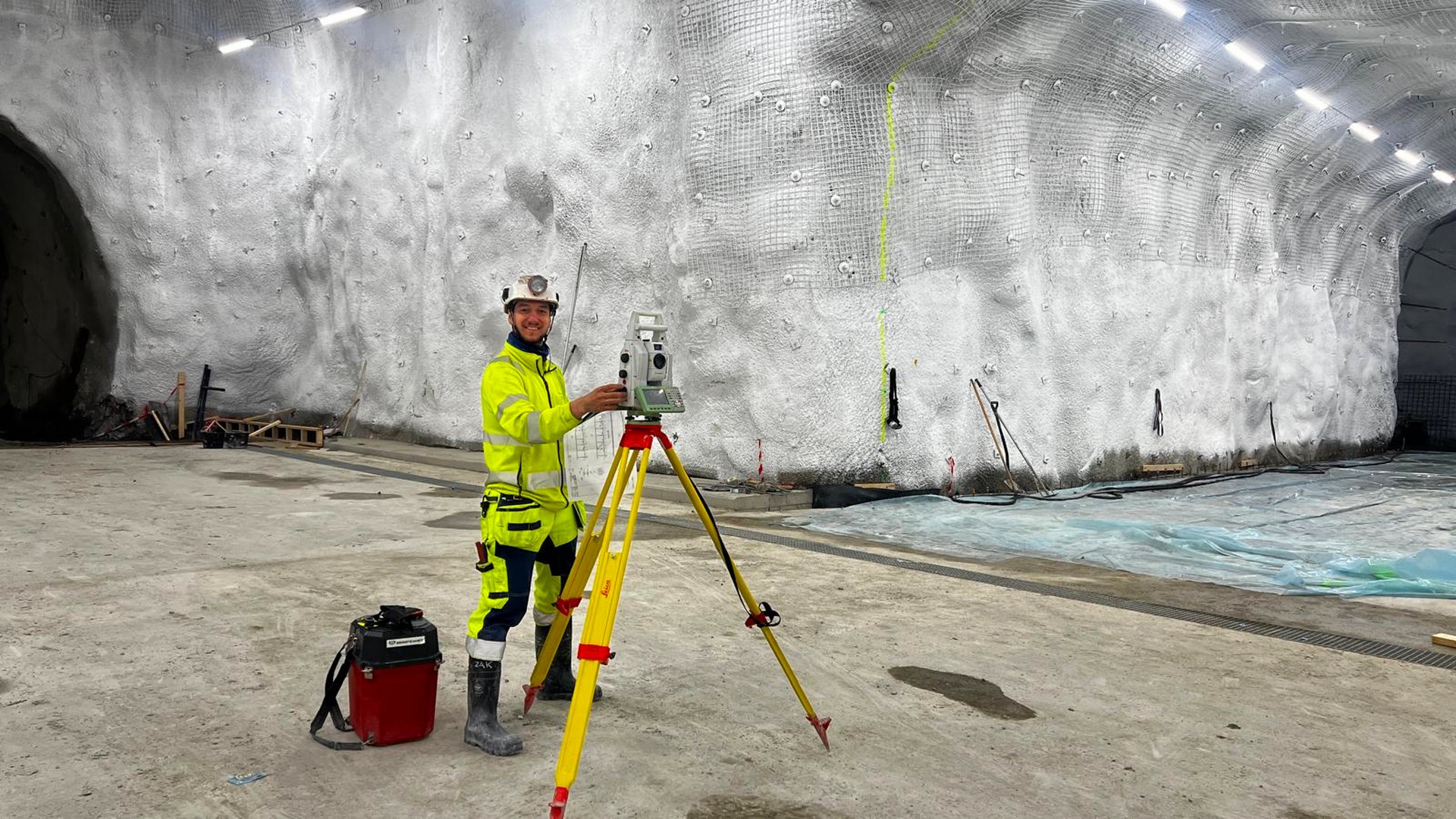
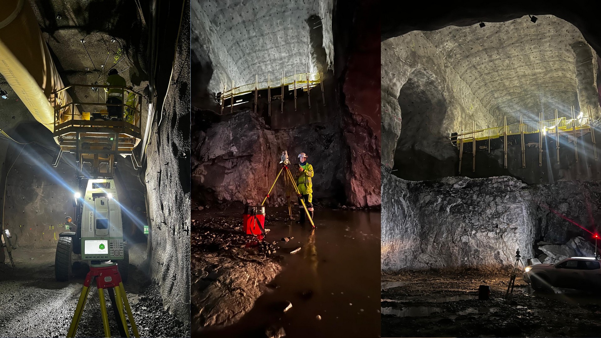
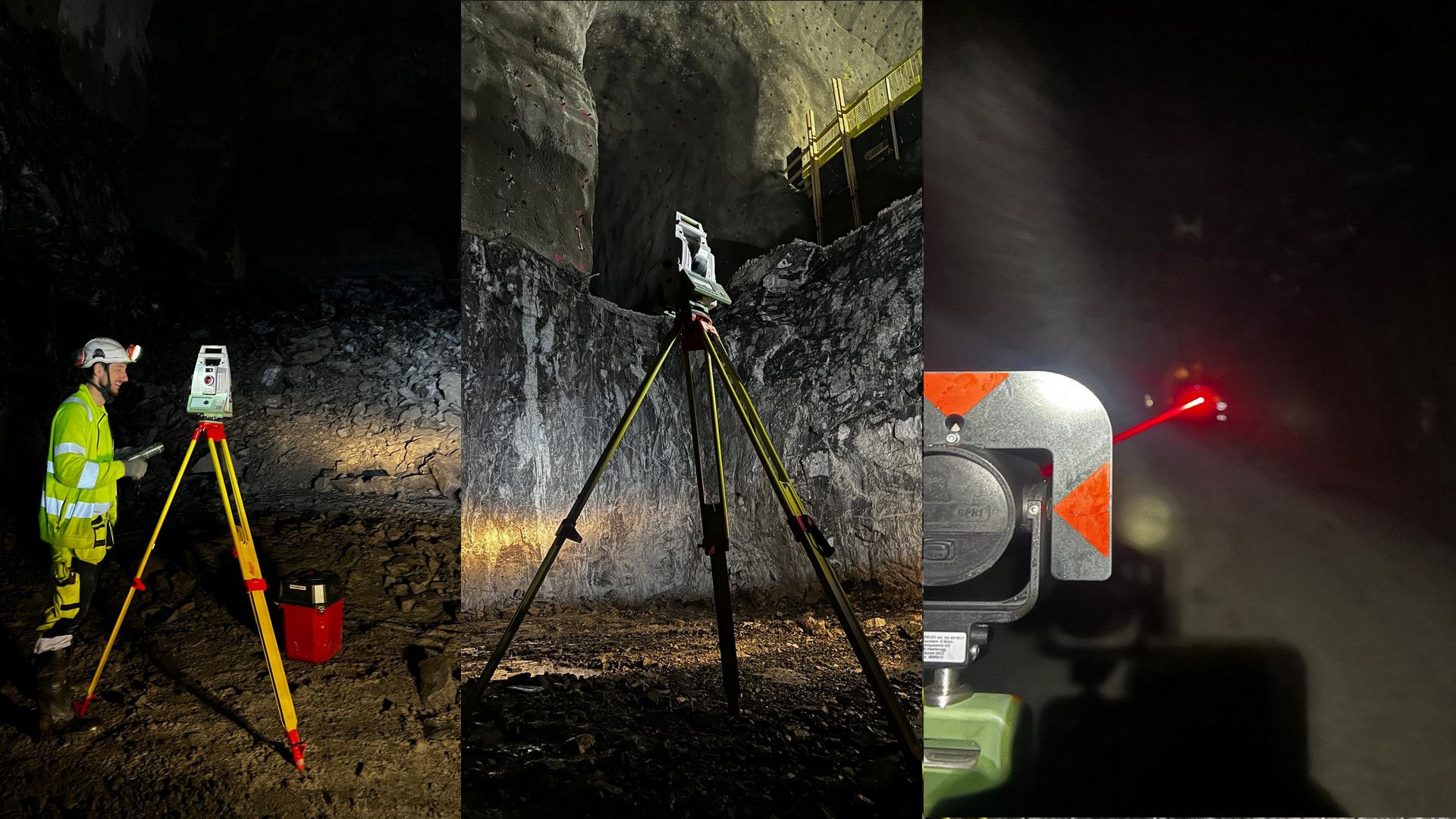
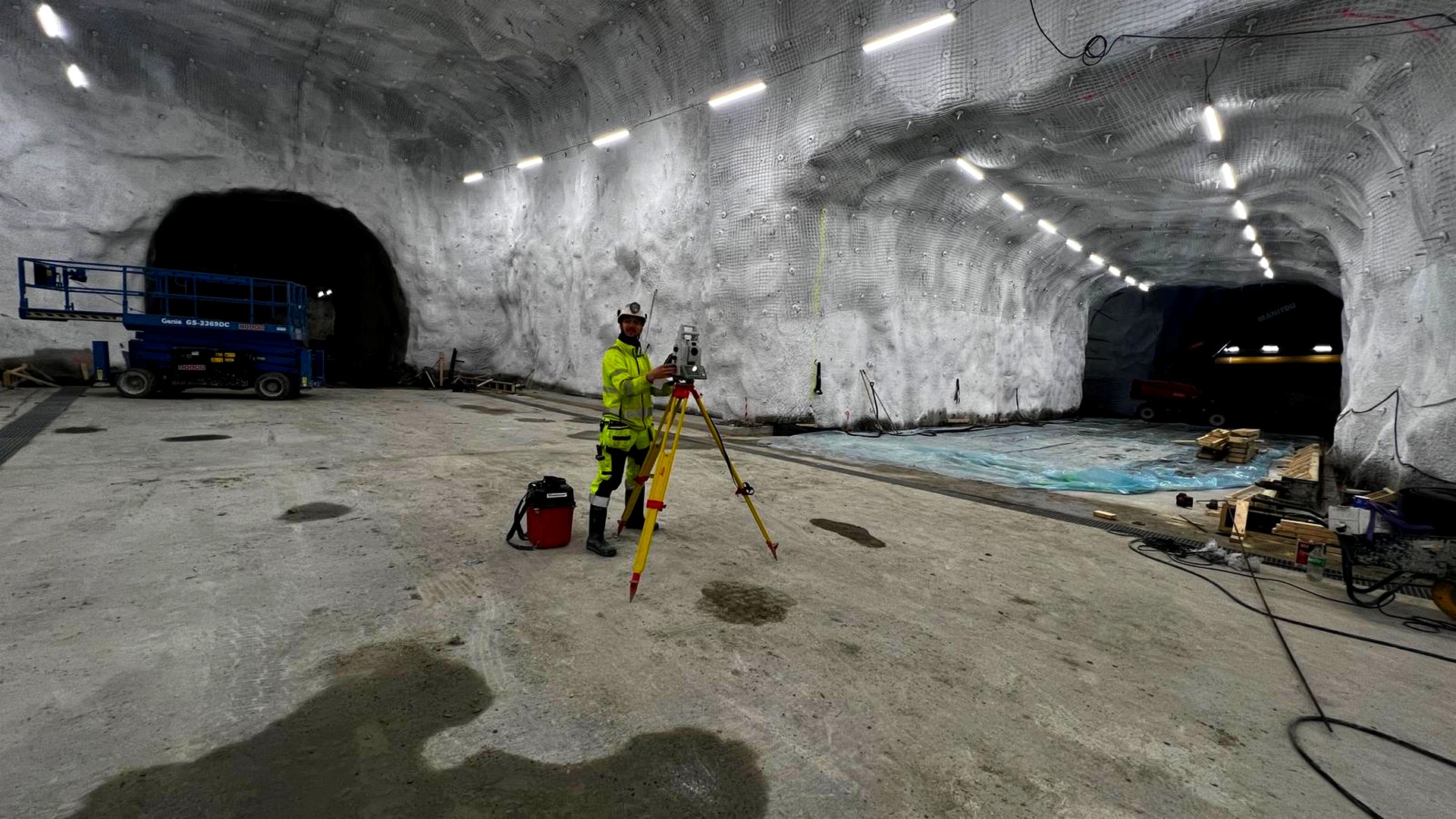
Geodesy in Slovakia has undergone a fundamental transformation in recent years. From traditional measuring chains and the first cadastral maps, we have moved into an era of satellites, laser scanning, and digital databases. Today, the work of a land surveyor is not just about physical measurements in the field, but primarily about processing high-precision data that ensures legal certainty for every landowner.

Ing.Jozef Žák
/

read more

Geodesy in Slovakia: A Blend of Tradition and Modern Technology

Ing.Jozef Žák
/

read more

Geodesy in Slovakia: A Blend of Tradition and Modern Technology

Ing.Jozef Žák
/

read more